A GPS system is something that offers a solution to a problem in society based on position determination using satellites. That sounds quite vague, but that’s why I’d like to explain it in this article.
A system that determines the position based on satellite signals is a GPS system. There are many different applications for a GPS system. Of course there is GPS navigation. But GPS systems are also used for surveying, autonomous vehicles, tracking, etc. And although these applications all have different functions, they all use a GPS receiver. Major advantages of a GPS system are that it is easy to apply and that it can be used anywhere in the world. A disadvantage of a GPS system is that sufficient satellite signals are required for accurate position determination.
To clarify everything about this topic, we will answer the following questions in this article:
- What is a GPS system?
- What applications are there for a GPS system?
- What are the components of a GPS system?
- How does a GPS system work?
- What advantages does a GPS system have?
- What are the disadvantages of a GPS system?
GPS system: the solution
You may not be able to read this entire article. Therefore, there is another opportunity to learn more about GPS system in general.
You can try a GPS measuring system via this website. Please look directly at this page .
You can request a demonstration of one of our GPS measuring systems on the same page. During this demonstration you can ask specific questions about the GPS system and of course also about other topics related to GPS surveying.
If you do not have time for a demonstration or would like to quickly try out the software of our GPS measuring systems, this is possible. Apglos Survey Wizard is the easiest software to perform GPS measurements. You can download it for free from the Google Play Store.
The Apglos Survey Wizard surveying app has full functionality with the GPS of your Android device. So you can fully test this app and it is free.
Of course, the accuracy of our GPS receivers is better than that of standard Android devices. So if you want to do a test with an accurate system, take a look at this page.
What is a GPS system?
A GPS system has become an indispensable part of today’s society. In fact, GPS systems are used for everything where position is important.
The meaning of GPS is Global Positioning System. In Dutch this is Global Position Determination System. The term GPS system is actually a bit ambiguous. The system is used twice.
In any case, a GPS system determines the position in the world. The world is divided into degrees for this purpose. This means that a GPS system can indicate a position for any position on the earth. The GPS system does this in latitude, longitude and altitude. Other terms for this are latitude, longitude and altitude.
The latitude goes from the north pole to the south pole. The maximum value of latitude is 90˚. This is at the North Pole. And the minimum value of latitude is -90˚. This value is then the south pole.
With the longitude it is slightly different. Here the world is divided into 360˚. The zero point of the longitude used by a GPS system is located in England at the town of Greenwich. With a GPS system this is 0˚. In an easterly direction the longitude is positive. In the Netherlands the longitude is around +4˚.
However, sometimes you may encounter a negative longitude. A negative longitude is also used. To arrive at a positive longitude you only need to add 360 degrees.
Fortunately, more and more applications of a GPS system show the direction of both latitude and longitude. This makes everything a lot clearer.
What applications are there for a GPS system?
A GPS system is a very broad concept. There are many applications of GPS systems. Below are a number of commonly used applications.
Navigation
Of course, one of the most used applications of GPS is navigation. With your phone you can navigate with, for example, Google Maps. But most cars now have built-in navigation with GPS.
The position, determined by GPS, is displayed on a map. And when the final destination is known, the GPS system calculates the route.
This means you can drive to any place you want without any problems. This is certainly the case when there are no road closures.
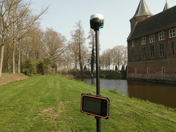
Surveying
Another application is surveying. That is the application that this website gps-systeem.nl is all about.
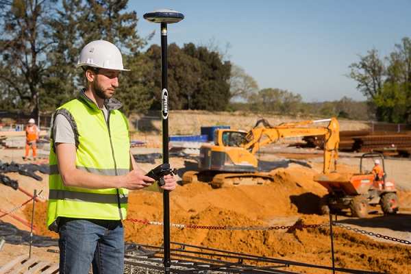
Measuring and recording existing and new situations is important in all construction projects. The new structure must fit into the existing situation and connect to this existing situation.
That is why measurements are taken for every construction project. Nowadays, surveying with a GPS system is the most commonly used solution for this.
Using such a system, the position can be determined with centimeter accuracy. The GPS equipment for surveying is therefore more accurate than that of navigation. The accuracy of a GPS system therefore depends on the application.
In addition to surveying with a GPS system for surveying, one can also stake out with such a system. Pickets are then placed in the exact position, so that the contractor can build the project in the right position.
GPS for a tractor
There are GPS systems for tractors. The GPS system ensures that the tractor can drive independently or autonomously.
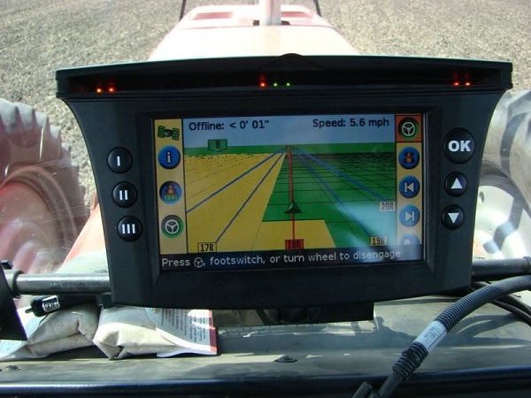
It is important that the tractor does not drive into a ditch. Position determination is therefore of enormous importance for the proper functioning of a GPS system on a tractor.
The developments in autonomous driving are now continuing. When a tractor drives in the field, there are few external factors. And one has influence on external factors, such as other vehicles and people.
That is not the case when cars want to drive independently. Then there are many other factors. And the risks are great. An autonomously driving car should of course not cause a collision.
The GPS system for autonomous driving is therefore not a simple system. This system must have been developed much further than that for navigation, for example.
GPS tracking
Then there is also GPS tracking. People want to know where they are for many different things.
This could be for a truck so that it can be recovered if stolen. The same of course also applies to other expensive objects.
But there are also GPS trackers for people with dementia. If they have a GPS tracker with them and can no longer find their way back, they can be found.
The same goes for pets. There are now collars with a GPS tracker. If the dog or cat has disappeared, you can search for the pet based on the position provided by the GPS system for tracking.
What are the components of a GPS system?
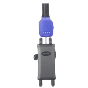
As you can see, there are various applications of a GPS system. And they all do something different. But they also have a similarity. All GPS systems use a GPS receiver.
A GPS receiver consists of:
- Antenna
- Small computer
- Power supply (battery)
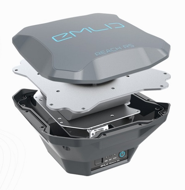
The antenna receives the satellite signals. After receiving the satellite signals, the antenna sends them to the small computer. The size of the antenna is important. The larger the antenna, the more satellite signals the antenna can receive. And the more satellite signals the GPS receiver has, the more accurately the position can be determined.
The computer in the GPS receiver calculates the position based on the satellite signals transmitted by the antenna. The computer uses the formula for this
R 2 =(Xo-Xs) 2 +(Yo-Ys) 2 +(Sun-Ss) 2
In this formula, R (the radius) is the known one, because the distance from the satellite to the antenna is known through the satellite signal. This leaves three unknowns. The computer calculates this, but requires sufficient satellite signals for this.
The computer of the GPS receiver communicates the calculated position with the part of the GPS system, where the position is ultimately processed. This then depends on the application.
Of course, the entire GPS receiver cannot function without a power supply. The power supply provides power for the computer and antenna.
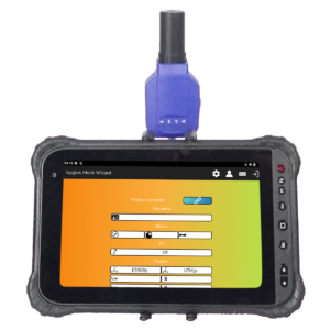
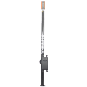
The other components of a GPS system depend on the application. For example, when surveying, the following components are needed in addition to the GPS receiver:
- Lead rod
- Tablet
- Surveying software Apglos Survey Wizard
- Tablet holder
How does a GPS system work?
The GPS receiver is therefore an important part of the GPS system. As explained above, it receives satellite signals.
However, not all satellite signals are the same. Not all satellites floating around the earth are for position determination. But a number of satellite constellations (or groups) are. These are GPS, GLONASS, GALILEO and BEIDOU.
The satellites of these groups all send a signal, which a GPS receiver can convert into a position when receiving sufficient signals.
The signal from the satellites is therefore important to determine the position. Such a positioning satellite actually says “Now I am here” every time.
So there is a time involved. And because the time of transmission is received and compared with the time of reception in the GPS receiver, the length of time the satellite signal was on its way can be determined.
When the duration is known and the speed of the signal is “constant”, the GPS receiver knows the distance between the satellite and the GPS receiver. And that is the R from the formula:
R 2 =(Xo-Xs) 2 +(Yo-Ys) 2 +(Sun-Ss) 2
The position of the satellite is then expressed in Xs, Ys and Zs. That leaves three unknowns. With sufficient satellite signals, the GPS receiver can resolve these three unknowns and determine the position of the GPS receiver.
This is how the GPS system works.
What are the disadvantages of a GPS system?
However, we immediately see a disadvantage. The satellite signal comes through the atmosphere. And in the atmosphere the speed of the satellite signal is not constant. That is also a reason that more than three satellite signals are needed to determine an exact position.
And even then it’s not that accurate. Depending on the application, it depends on whether the accuracy is sufficient.
For example, in surveying applications, centimeter accuracy is necessary. This cannot be achieved with just a GPS receiver. That is why a correction is also necessary when surveying with GPS. This correction, in which the results of the GPS receiver at a fixed point are compared with the GPS receiver in the field, ensures that measurements can be taken with centimeter accuracy.
Another disadvantage is that GPS signals can be blocked by trees, tall buildings and the like. As may be seen from this article, sufficient satellite signals must be received by the GPS receiver. Obstacles can ensure that insufficient satellite signals are received by the GPS receiver to determine the position.
What advantages does a GPS system have?
But besides these disadvantages, there are also many advantages. A GPS system is easy to use. Actually, all you have to do is turn on the system. There are few other settings. Although the latter of course depends on the application.
For example, with navigation you only need to set your destination. There are also few settings when surveying when you do this with the Apglos Survey Wizard surveying app. Check out the video below to see how few settings there are in this surveying app.
In addition to the fact that working with GPS systems is easy, the entire GPS system is still under development. At first there were only GPS satellites from the United States. But they were followed by Russia, Europe and China.
This means that one is no longer dependent on one party for position determination. In addition, new positioning satellites continue to be launched. And the more positioning satellites floating around the earth, the easier it becomes for a GPS receiver to receive enough satellite signals to determine the exact position.
As a result, obstacles such as trees and tall buildings will have less and less influence on GPS systems.
Final conclusion about GPS system
This was a whole article about GPS system in general. There is a lot to report on this topic of GPS surveying. We hope that you have learned at least a few things from it and that you can benefit from them.
However, everything written in this article is theory. If you want to put this theory into practice, you can.
You can try or buy a GPS measuring system via this website. When you do that, you can immediately put into practice what you learned by reading this article about GPS systems. And you can see whether working with our GPS measuring equipment is something for you.
Of course, when you try or buy one of our GPS measuring systems, you will receive a short and clear explanation, so that you can get started right away.
If you would like a demonstration first, you can also request one via the pages mentioned above. During a demonstration or a brief explanation you can also ask specific questions about GPS systems.
 Demo inplannen? Dat kan via whats!