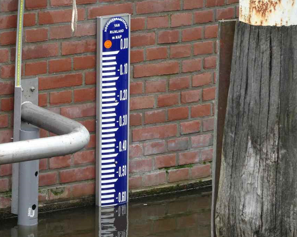
Measuring NAP height is important. But is it New Amsterdam Level or Normal Amsterdam Level? In any case, in the Netherlands heights are measured relative to NAP.
NAP stands for Normal Amsterdam Level. This is the height that is approximately equal to the sea level in the North Sea. The heights in the Netherlands are indicated in relation to this level. By measuring NAP heights, projects can be properly connected to the surrounding area, but also problems such as flooding can be prevented. To measure NAP height, a spirit level, rotating laser or GPS measuring equipment is often used. The easiest method for measuring NAP height is with GPS, because a known NAP height is not required.
To clarify everything about this topic, we will answer the following questions in this article:
- What does NAP mean?
- What is NAP?
- How is NAP determined?
- Why is the NAP height important?
- What are the methods for measuring NAP height?
- Why is GPS measuring the easiest way to measure NAP height?
Measuring NAP height: the solution
You may not be able to read this entire article. That is why there is another option to find out more about measuring NAP height.
You can try a GPS measuring system via this website. Please look directly at this page .
You can also request a demonstration of one of our GPS measuring systems. During this demonstration you can ask specific questions about measuring NAP height and of course also about other topics related to GPS surveying.
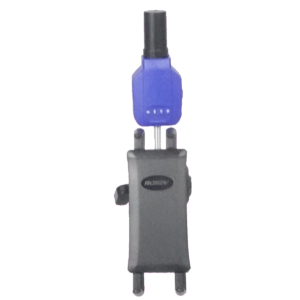
If you do not have time for a demonstration or would like to quickly try out the software of our GPS measuring systems, this is possible. Apglos Survey Wizard is the easiest software to perform GPS measurements. You can download it for free from the Google Play Store .
The Apglos Survey Wizard surveying app has full functionality with the GPS of your Android device. So you can fully test this app and it is free.
Of course, the accuracy of our GPS receivers is better than that of standard Android devices. So if you want to test with an accurate system, take a look at this page .
What does NAP mean?
There is quite a bit of confusion about the meaning of NAP. One says that NAP stands for Normal Amsterdam Level and the other says New Amsterdam Level. But what is the right thing now? According to the Rijkswaterstaat website, NAP stands for Normal Amsterdam Level. And that seems like a reliable source. NAP stands for Normal Amsterdam Level.
What is NAP?
NAP is therefore a certain level. The heights in the Netherlands are indicated in relation to this level. For example, the highest point in the Netherlands is the Vaalserberg, 322.4 m above sea level. But there are also parts of the Netherlands below NAP.
NAP is therefore the reference plane or zero point in terms of height. But then the question remains what the reference plane represents. Officially, the NAP reference level is equal to the average water level of the North Sea.
But the actual origins of NAP are a better story. In the 17th century there were many floods in the Netherlands, including the All Saints Flood in 1675, and there was a lot of flooding. The city of Amsterdam wanted to protect itself against the floods.
The Netherlands had long been familiar with building dikes. Yet Amsterdam encountered a problem. People did not know how high to build the dikes.
That is why the highest water levels in the IJ were measured every day. At the time, this was still in an open connection with the Zuiderzee, which is now the IJsselmeer. The people of Amsterdam measured a complete year from September 1683 to September 1684.
The average of all measurements was determined. This was therefore the average highest tide level of the IJ. This average level was called Stadspeyl, but also Amsterdams Peil.
The mayor of Amsterdam at the time, Johannes Hudde, had 8 large marble stones built in locks around the IJ, containing a quarry and the height. These were the predecessors of the now well-known gauge scales.

Over the course of the 18th century , this Amsterdam Peil was spread to other parts of the Netherlands. This was done by means of leveling. Due to its general spread, the Amsterdams Peil was declared nationally applicable by a royal decree.
An accuracy leveling was carried out in 1875. This led to an overall improvement in the level or reference plane. This means that there were fewer deviations in the level.
However, a new name had to be created so that everyone would use the improvement in the reference level as a baseline. This is now the Normal Amsterdam Level.
How is NAP determined?
The NAP has therefore been determined by means of high water level measurements in the IJ. Now NAP is a permanent fixture.
To make the NAP available everywhere, a network has been created with benchmarks. At the end of the 19th century there were 4,000 benchmarks in the Netherlands. The benchmarks are managed by Rijkswaterstaat.
By means of levelling, the height of the benchmark could be transferred to the location where this height information was needed.
With only 4,000 benchmarks, these distances from the benchmark to the project location were sometimes very large. As a result, it took a long time to get the height to the project location and there was a high chance of errors. With every stroke (two level measurements) the staff can be read incorrectly. And when that happens, an error occurs.
That is why more and more benchmarks were placed in the Netherlands. At its peak, there were more than 35,000 benchmarks, which were measured by Rijkswaterstaat every few years by means of leveling.
Thanks to GPS, fewer benchmarks are now needed, because with GPS the NAP height can be determined directly at any point.
Why is the NAP height important?
The people of Amsterdam already knew in the 17th century how important it was to be able to determine the height. If they had built a dike that was lower on one part than on another, everything could still have flooded.
By using NAP they could all build the dikes at the same height. This allowed them to prevent flooding.
Another important point to use NAP height is to prevent flooding. Rainwater flows to the last point after it falls. By expressing everything in NAP, you can, for example, see on a drawing where the water will flow. And if this causes a nuisance, it can be resolved immediately.
Furthermore, NAP is the same for everyone. It is the reference level. This means there are no communication problems. That way everyone can work with it.
And this was also noticeable beyond the Dutch borders in the 19th century . Prussia took over the NAP in 1876. And then more countries followed. For example, in 1955 a number of countries established a European altitude network based on the NAP. And in 2008, the European Commission established the European Vertical Reference Frame, a reference framework for heights. That frame of reference is still based on the NAP.
What methods are there for measuring NAP height?
There are a number of methods for measuring NAP height. I have already mentioned the first. This was used to distribute the NAP across the Netherlands. This is the leveling.
Measure NAP height with leveling
When leveling, it is used with a spirit level and a staff. The staff is first placed at a point of known height. The staff is then read using the spirit level instrument. The staff is then moved in the direction of the project. There too, the staff is read using the spirit level instrument. This whole thing is called a stroke.
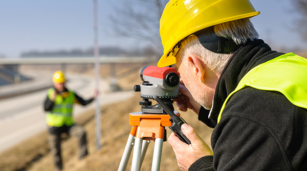
Then the staff is left where it is, but the level instrument is moved. And then they strike again.
This is done until you reach the location where you need the height. The entire route must then also be measured again, so that any closing error can be determined.
Two people are needed to measure NAP height with a spirit level instrument.
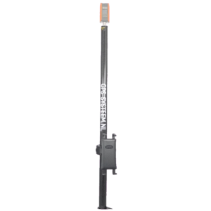
Measure NAP height with rotating laser
At small distances the NAP height can be measured with a rotating laser. The rotating laser must then be set up in a place where one can see the point with a known NAP height, but where one can also see the point where the height is desired.
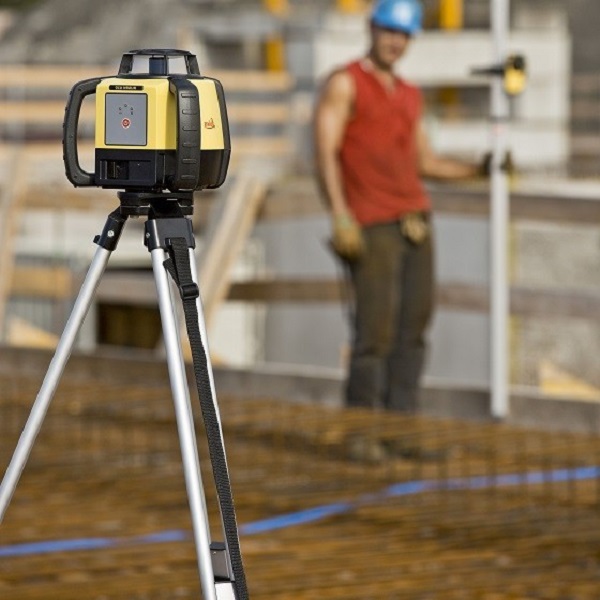
When the rotating laser is set up, the staff with the receiver can be placed at the point where the height is known. And then the receiver can read the staff at the point from which the NAP height must be determined.
This can be performed by a single person. The distance for this method is preferably not that great. It is not convenient to move a rotating laser.
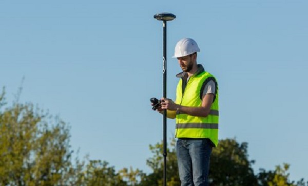
Measure NAP height with GPS
The last method I describe here is measuring NAP height with GPS. A GPS measuring system actually determines the exact location where the GPS system is.
The GPS measuring system does this in latitude, longitude and altitude. And that does not completely correspond with RD coordinates and NAP height.
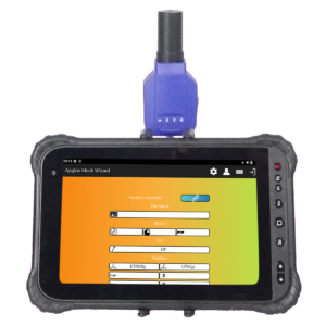
With the simple surveying software Apglos Survey Wizard, which is supplied with all our GPS measuring systems, this latitude, longitude and altitude are automatically converted into RD coordinates and a NAP height. The RDNAPTRANS2018 transformation determined by the Land Registry is used for this.
Why is GPS measuring the easiest way to measure NAP height?
The title of this section says it all. Measuring with GPS is the easiest method for measuring NAP height.
And this has to do with one important thing. When using GPS, no reference points are needed. This means that when using GPS you do not have to subtract a height from a benchmark.
With all our GPS measuring systems you can determine a NAP height at any location, as long as the GPS receiver of the measuring system receives sufficient satellite signals.
This makes measuring NAP height with GPS much faster. It’s more effective. Only one person is needed to determine the NAP height with GPS.
In addition, if the methods of leveling or rotating laser are used, the point measured with GPS is often used as a basis. These last two methods also require calculations. Addition and subtraction are required, which can lead to errors.
This is not the case when using GPS to measure a NAP height.
Final conclusion about measuring NAP height
This was an entire article about measuring NAP height. There is a lot to report on this topic of GPS surveying. We hope that you have learned at least a few things from it and that you can benefit from them.
However, everything written in this article is theory. If you want to put this theory into practice, you can.
You can try or buy a GPS measuring system via this website . When you do that, you can immediately put into practice what you learned by reading this article about measuring NAP height. And you can see whether working with our GPS measuring equipment is something for you.
Of course, when you try or buy one of our GPS measuring systems, you will receive a short and clear explanation, so that you can get started right away.
If you would like a demonstration first, you can book one here. During a demonstration or a brief explanation you can also ask specific questions about measuring NAP height.
 Demo inplannen? Dat kan via whats!