RD coordinates in Google Maps is something that is not directly related, but would be very useful.
In the Netherlands, RD coordinates are used. It would therefore be very easy in the Netherlands if you could use RD coordinates in Google Maps. Unfortunately, this is not possible as standard. But with a software package such as Apglos Survey Wizard you can use RD coordinates in Google Maps. Especially in combination with GPS measuring equipment, there are suddenly many possibilities.
To properly explain the whole thing, a number of questions need to be answered:
- What are RD coordinates?
- Why aren’t there standard RD coordinates in Google Maps?
- What can you do with RD coordinates in Google Maps?
RD coordinates in Google Maps: the solution
If you don’t want to read this entire article and go straight to the solution, you can.
It is not possible to use RD coordinates directly in Google Maps as standard. You need a tool for this and the best tool is Apglos Survey Wizard. Apglos Survey Wizard is professional surveying software that can be understood by everyone.
So it is easy to use. And in addition, the RD coordinates are fully integrated in this software. If you would like to try the software yourself, you can do so by downloading it from the Google Play Store .
This surveying software works on any Android phone or tablet. It then uses the Android device’s GPS. This is usually not very accurate, but it can give you a good impression of Apglos Survey Wizard and how this software allows you to work with RD coordinates in Google Maps.
If you want to try the software in a more accurate way, you can also try a GPS measuring system via this website .
During the trial period you will have a complete GPS surveying set at your disposal, so that in addition to the software, you can also try out the hardware, such as a GPS receiver and a weatherproof tablet.
But with regard to the RD coordinates in Google Maps, the Apglos Survey Wizard software is the most important.
What are RD coordinates?
RD in RD coordinates stands for Rijksdriehoek. RD coordinates are therefore National Triangle coordinates. Officially they are called coordinates in the National Triangle Measurement system.
But of course that’s quite a mouthful. That is why they say RD coordinates.

But what exactly is the RD coordinate system? And why do we use this coordinate system? Those are very interesting questions.
It is important to know that the earth is round. And although the Earth is round, most overviews of the world or countries are indicated in a two-dimensional thing, or a map.
There are many different ways to make this transformation from 3D (a sphere) to 2D (a map). In the Netherlands it has been decided to make this transformation to the RD coordinate system. The Land Registry officially keeps track of the transformation.
The RD coordinate system gives each location an x and a y value for the Netherlands. This allows all locations in the Netherlands to be neatly depicted on one map. And this RD coordinate system has been quite well thought out.
For example, within the Netherlands the X coordinate is always between 0 and 280 km. And the Y coordinate is between 300 and 625 km. This ensures that just by looking at the size of the coordinate you can know which direction, x or y, the coordinate is in.
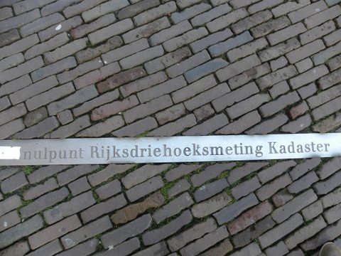
The official 0 point of the RD coordinate system is somewhere near Paris.
As mentioned, the Land Registry maintains the RD coordinate system. They have to do this because the Netherlands is moving. The Netherlands moves a few centimeters every year and it does not do so as a whole, but in different directions.
As a result, the transformation between 3D (a sphere) to 2D (a map) changes regularly. The Kadaster recently published a new transformation, which is the RDNAPtrans2018.
Kadaster can only adjust the transformation by measuring. Nowadays this is done with GPS. Kadaster uses similar GPS measuring equipment as you can find on this website.
But in the past, the Land Registry had to measure about 5,500 points. The distances between points, mainly church towers, were measured. The measurements were made in triangles and were over the entire country (Region) and hence the name.
Why aren’t there standard RD coordinates in Google Maps?
All of the above is about RD coordinates. And as you have read, it only concerns the Netherlands.
That is also the main reason that there are no RD coordinates in Google Maps. The Netherlands is a small country and each country has its own coordinate system. Some countries even have more than one coordinate system.
It is not feasible to have all coordinate systems in Google Maps. That is why Google Maps only works with one coordinate system and that is WGS84.

The WGS84 does not use X and Y coordinates, but it uses latitude or longitude. Latitude is the number of degrees in a northerly direction and longitude is the number of degrees in an easterly direction.
You will immediately see that this is not in meters or any other distance measure, but in degrees of an arc. The latitude runs from +90 to -90 degrees. And the longitude runs from 0 to 360 degrees. However, in some cases the longitude ranges from -180 to +180 degrees is used.
Something strange happens with the longitude. The circumference of the Earth at the equator is much larger than at the north and south poles. However, for both locations the maximum longitude is 360 degrees.
Because Google Maps is usually depicted on a flat surface, something strange arises. The card is pulled out at the north and south poles. This causes distortion in the map.
And that’s acceptable for what Google Maps is normally used for. However, this deformation is not allowed when measurements are required. Then the RD coordinate system is really necessary in the Netherlands.
Apglos Survey Wizard is the solution for RD coordinates in Google Maps
Still, you can project RD coordinates on Google Maps. You will need additional software for this. And this is Apglos Survey Wizard. You can download this from the Google Play Store .
Before you can use the RD coordinates in this software, you must set the correct coordinate system. You do this under Other Settings. In the video below you can see exactly how to do this.
You must set the coordinate system in Apglos to RDNAPtrans2008 or RDNAPtrans2018 to be able to work with RD coordinates.
As you can see there are many coordinate systems. And Apglos Survey Wizard is used all over the world.
After setting the survey software to the RD coordinate system, you can measure in RD and open files in RD. And that is ultimately what everyone wants.
What can you do with RD coordinates in Google Maps?
National triangle coordinates in Google Maps are useful, but not entirely possible without the interim solution Apglos Survey Wizard.
But now that you know how to see RD coordinates in Google Maps, there are many possibilities.
Firstly, you can see live on the screen in Apglos Survey Wizard which RD coordinate you are at. This also allows you to go exactly to the coordinate you want. This is even facilitated in the stakeout screen.
Actually, having RD coordinates in Google Maps is the first step to easy surveying. You combine the familiarity of Google Maps with the functionality of surveying software. And that is Apglos Survey Wizard.
Allows you to project drawings with RD coordinates in Google Maps. This allows you to see exactly how the new situation compares with the existing situation. You can also look up these points and lines as already described.
You can also record RD coordinates on Google Maps. By measuring with the point, line, arc and others buttons you can make a complete measurement using Google Maps as a base. The great thing is that ultimately the result is in RD coordinates, which provides a good basis on which a designer, architect or engineer can continue.
There are even more options. You can manually enter an RD coordinate or read a point list of RD coordinates. You can even navigate to this using Apglos Survey Wizard. If you want to know exactly how to do that, watch the video below.
As you can see, the possibilities are endless. Are you interested in RD coordinates? Or are you interested in Google Maps? Or both? Then it is definitely worth trying Apglos Survey Wizard.
Try working with RD coordinates in Google Maps yourself
So you can try to work with RD coordinates in Google Maps yourself. This can be done by purchasing or renting a GPS measuring system via this website. With such a system you can easily work with RD coordinates using Google Maps as a base. The results will be the same as the results of a surveyor.
The surveying software Apglos Survey Wizard transforms the RD coordinates to the correct position on Google Maps. This allows you to see the points, lines, arcs and other elements in the right place in Google Maps.
With the GPS measuring equipment you can even find all RD coordinates with centimeter accuracy.
However, if you first want to try a GPS measuring system yourself, you can do so here.


 Demo inplannen? Dat kan via WhatsApp!