Whether you can determine the property boundary yourself is a frequently asked question. The exact location of the boundary is often a source of conflict. But having the Land Registry determine the property boundary is expensive.
You can determine the boundary yourself. You only need a GPS system and some free software packages, QGIS and Nanocad. All Dutch property boundaries are available online and you can convert them using this software and place them in the GPS system. You can prevent conflicts by determining the property boundary yourself.
To clarify everything about this topic, we will answer the following questions in this article:
- What is determining a property boundary?
- What do you need to determine a property boundary?
- How can you determine the property boundary yourself?
- What are the advantages of determining the property boundary yourself?
Determine your own property boundary. Is that possible?: the solution
You may not be able to read this entire article. That is why there is another option to find out more about determining your own property boundary. Is that possible?.
You can try a GPS measuring system via this website. Please look directly at this page .
You can also request a demonstration of one of our GPS measuring systems. During this demonstration you can also ask specific questions about determining your own property boundaries. Is that possible? and of course also about other topics related to GPS surveying.
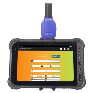
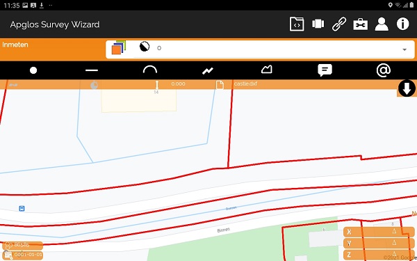
If you do not have time for a demonstration or would like to quickly try out the software of our GPS measuring systems, this is possible. Apglos Survey Wizard is the easiest software to perform GPS measurements. You can download it for free from the Google Play Store .
The Apglos Survey Wizard surveying app has full functionality with the GPS of your Android device. So you can fully test this app and it is free.
Of course, the accuracy of our GPS receivers is better than that of standard Android devices. So if you want to test with an accurate system, take a look at this page .
What is determining a property boundary?
Determining a property boundary is also called boundary reconstruction. But it must first be clear what a property boundary is.
The boundary of the plot indicates the end of the plot. After this ending, another plot begins. And often this other plot has a different owner. It is the legal separation between two landowners.
All these plot boundaries are administered by the Land Registry. This means that the Land Registry keeps track of where all the borders in the Netherlands are and who owns all these plots. As you can imagine, this is a very large database.
And this database is also constantly changing. Plots are merged or divided. That is also often a reason to determine the boundary or to carry out a boundary reconstruction.
During a boundary reconstruction, the exact boundary of a parcel is determined. This boundary is then marked with pickets or poles.
This makes the border visible and it can be determined whether everyone is adhering to the rules. There are many rules regarding property boundaries.
Of course, you are not allowed to build anything beyond the property boundary. But there are also rules regarding the property boundary for other matters. Zoning plans often contain rules about how far you can build something from the property line.
So if you want to do something near the property line, two things are important. First of all, it is of course important to find out the rules about what you want to do. But it is also important to know where exactly the property boundary is.
And yes, you can determine the property boundary yourself.
What do you need to determine a property boundary?
You don’t need much to determine a property boundary. That’s already a reason to do it yourself.
You really only need four things.
- QGIS or another program to convert GML files
- NanoCAD or another program to process files
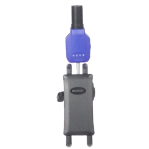
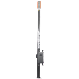
- One of our GPS measuring systems (purchase or rental )
- Marking material such as pickets or poles or chalk or a spray can
I describe the exact steps to determine the property boundary yourself in the chapter below. But first I will explain briefly why you need the above items to determine the property boundary.
QGIS is a GIS program. This is very complete, but the biggest advantage is that it is free. You can download it for free on this website . The Land Registry has published the property boundaries via so-called GML files. And you can convert these GML files to DXF files with QGIS. A DXF file is a general file for exchanging drawings.
However, the GML files that the Land Registry makes available cover such a large area that they are not really workable. Therefore, it is wise to reduce the size of the file created with QGIS and remove all unnecessary boundaries. This can be done with the drawing program Nanocad. This program is also free and can be downloaded from this website .
Our GPS measuring systems can load the DXF file that you have created with NanoCAD. And with the help of our GPS measuring systems you can then locate the property boundary. It’s a bit of geocaching to the centimeter.
And of course, if you have found a point on the property boundary with our GPS measuring systems, you will of course mark it with a picket, pole or a spray can. This of course depends on the surface.
How can you determine the property boundary yourself?
To determine the property boundary yourself, you must go through a number of steps:
- Downloading the property boundary data
- Converting the downloaded boundary file to DXF
- Removing unnecessary data in the DXF
- Finding the property boundary in the field with GPS measuring equipment
- Marking the property boundary
So it’s just five simple steps. And I’m sure you can do it.
Step 1: Downloading the property boundary data
This is an important step in determining the property boundary. The good thing is that you can simply download the property boundaries in the Netherlands. There is a website called PDOK. PDOK stands for Public Services on the Map.
And this website was created through a collaboration between the Land Registry, the Ministries of Infrastructure and Water Management, the Interior and Kingdom Relations and Economic Affairs and Climate, Rijkswaterstaat and Geonovum. This website can therefore be seen as reliable.
On this website you can find a lot of information about the spatial environment in the Netherlands and therefore also about the property boundary. The map used for managing the property boundaries is called the Basic Registration Land Registry (BRK).
This can be found via this link .
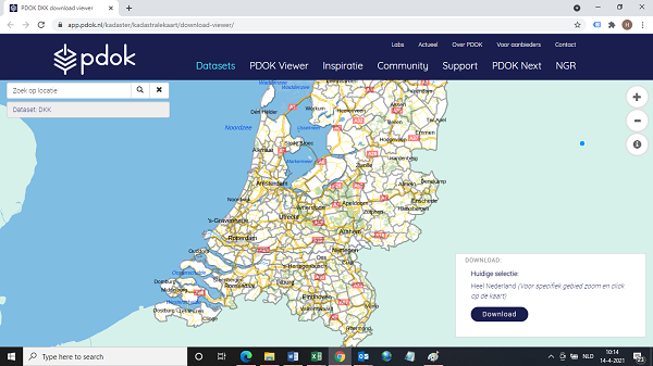
When you are on the page, zoom in on the plot for which you want the plot boundary. When you have zoomed in sufficiently, click with the right mouse button on a point on the map that is outside your field. Then click on a point on the map on another side of your plot that is also outside the plot for which you want to determine the boundary.
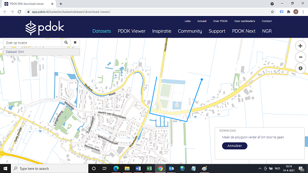
Continue to do this until you have completely drawn a plane around your plot. When you have done that, click with your mouse on the first point.
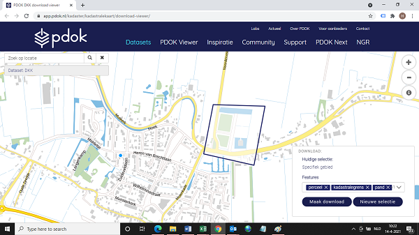
You will see a screen appear at the bottom right. And then click on the Create Download button . The property boundary data are then collected. When this is completed, a new screen will appear at the bottom right.
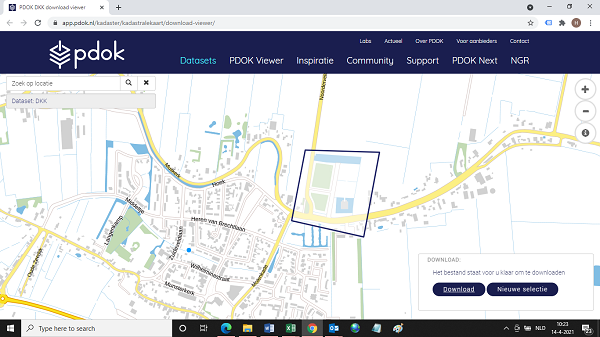
Click on the Download button here to download the property boundary data. Then a file called extract.zip will be downloaded.
You must unzip this file. You probably have four files on your computer.
Step 2: Converting the downloaded boundary file to DXF
These files contain the information about the property boundaries that you want to determine. But the data still needs to be put into a file that can be read by the GPS measuring system. You use QGIS for this. I always use the Desktop version of QGIS.
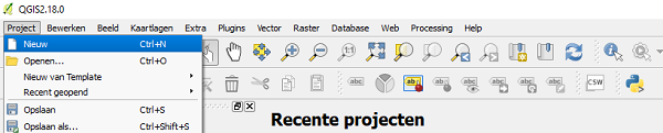
It’s a fairly large program, so it usually takes a while for QGIS to start up completely. But once QGIS is started, go to Project -> New .
In the left Panel Browser you can then search for the files extracted from step 1.
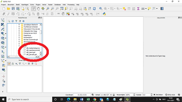
Double-click with the mouse on the dkk_kadastralegrens.gml file. A new selection screen will probably appear.
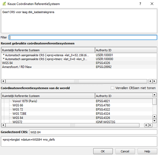
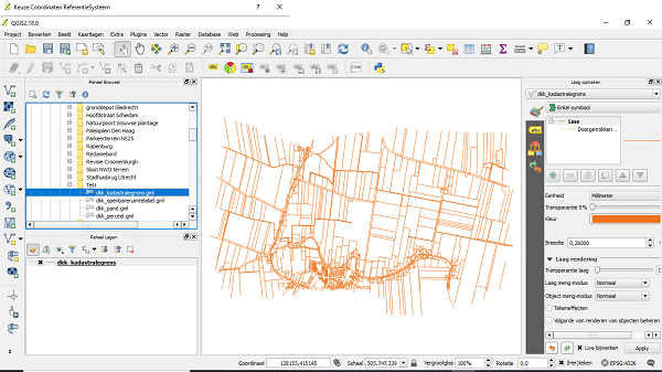
Here you choose Amersfoort / RD New . And then click OK . You will see the field boundaries appear in QGIS.
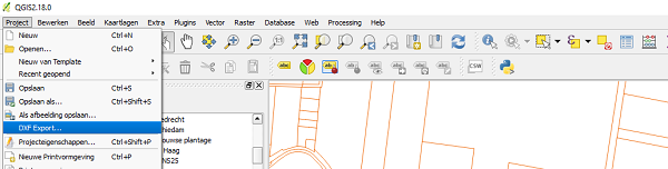
Then go to Project -> DXF export . And a new screen appears.
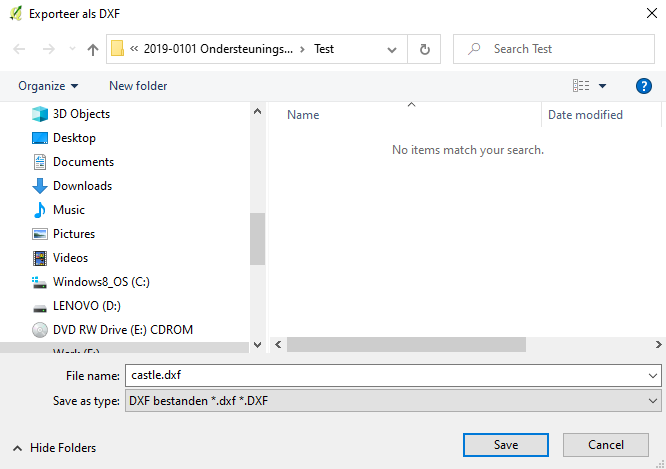
When you click on the button with the three dots you can enter the name of the file and you can indicate where the DXF file will be saved.
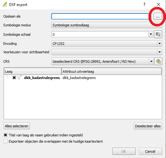
After specifying the name and folder where you want to save the file, click the Save button.
Then click the OK button .
The file has been saved.
Step 3: Removing unnecessary data in the DXF
As you saw in step 2, the file contains many property boundaries. And you don’t need most of them. So it is important to clean up the file a bit. This will make work outside in the field a lot easier.
I use Nanocad to clean up the file. Nanocad allows you to open the saved file from step 2.
When you open the NanoCAD program, a popup will appear.
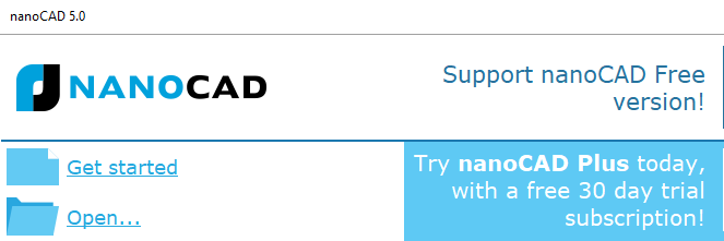
Here you click Open to open a file. A screen appears.
In this screen, locate the file from step 2 and then click the Open button .
You can select the property boundaries with the mouse by clicking on them. If you want to select multiple property boundaries at the same time, you can click on a point that is not on a property boundary and do so twice to create a rectangle.
All property boundaries within that rectangle are then selected.
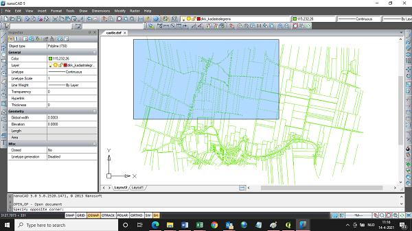
If, after selecting the boundary lines to be removed, you type E and press the Enter button, you will see that Nanocad has removed these boundary lines.
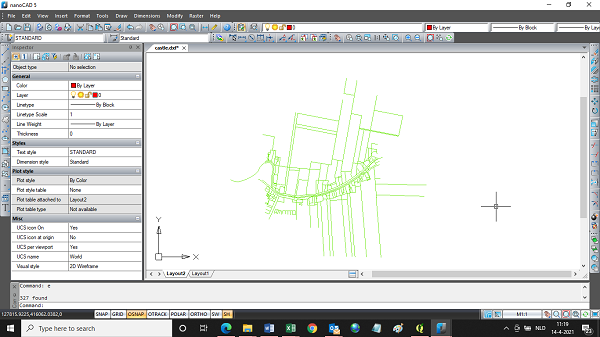
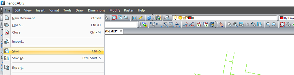
Do this until only the boundaries you need remain. Then go to File -> Save to save the property boundaries to be determined.
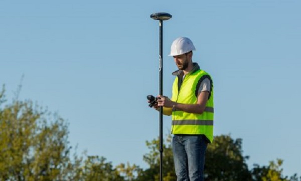
Step 4: Finding the property boundary in the field with GPS measuring equipment
It is then easy to determine your desired property boundary with our GPS measuring equipment. Our surveying software is completely in Dutch and when you buy or rent GPS measuring equipment from us , you will always receive a short but very clear explanation specifically about the purpose for which you want to use the GPS measuring equipment.
Furthermore, our GPS measuring systems are fully preset before we deliver them. So you don’t have to worry about this.
After launching our surveying software, go to the File menu -> Open. And you click No because you don’t want to keep the existing data.
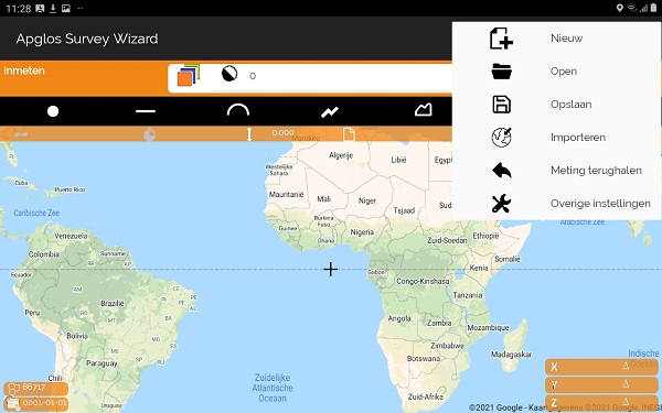
A new screen will appear.
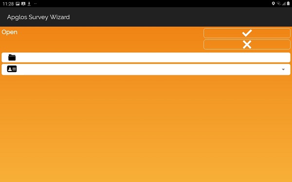
In the new screen, click next to the folder icon, after which a new screen will appear.
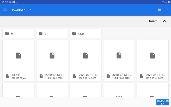
In this new screen, go to the folder where you saved the file on the tablet. And then click on select folder. The previous screen is updated.
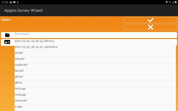
And next to the ID card icon, choose the file with the property boundaries you want to determine. Then click the OK button at the top right of the screen. A new screen appears.
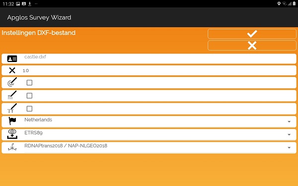
These are the settings as we have set them for you, so that nothing can go wrong. So here you just have to click on the OK button at the top right.
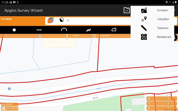
The property boundaries are then loaded into Apglos Survey Wizard. You can access the stakeout screen via the Screen Menu -> Stakeout .
On the left side of the screen you will see an arrow pointing to the direction of the property boundary. Below that is the horizontal distance to the property boundary.
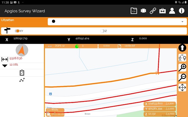
You can use this to determine the boundary when the indicated horizontal distance is 0. You will also hear a sound. And then you have found the boundary.
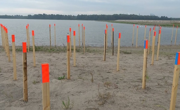
Step 5: Marking the property boundary
Once you have found the property boundary, you can mark it. Marking property boundaries is often done with poles or pickets. That depends on what your preference is.
But the most important thing is of course that by following these five steps you can determine the boundary yourself. You don’t need anyone else for this anymore.
What are the advantages of determining the property boundary yourself?
The great thing about determining the boundary yourself is of course that you can do this wherever and whenever you want. You don’t have to wait for a surveyor. This means that you will have clarity about the location of the property boundary more quickly.
And clarity is important. You can also save on costs by determining the property boundary yourself. If you have to have a surveyor come for a boundary reconstruction, to determine the property boundaries, this will incur high costs.
Surveyors work in half days. And with call-out costs. To carry out a border reconstruction, a surveyor will quickly charge at least €500 excl. VAT. The costs of course depend on the size of the boundary reconstruction and the number of boundaries that need to be determined.
What you save in surveyor costs can be better invested in something else.
But there are of course also cases where it is useful to have a surveyor determine the property boundary. This is mainly the case when there is a conflict over the property boundary. It is always wise to have a third and independent party determine the property boundary.
Final conclusion about determining your own property boundary. Is that possible?
This was an entire article about determining your own property boundary. Is that possible?. There is a lot to report on this topic of GPS surveying. We hope that you have learned at least a few things from it and that you can benefit from them.
However, everything written in this article is theory. If you want to put this theory into practice, you can.
You can try or buy a GPS measuring system via this website . If you do that, you can do so by reading this article about determining your own property boundary. Is that possible? put into practice immediately. And you can see whether working with our GPS measuring equipment is something for you.
Of course, when you try or buy one of our GPS measuring systems, you will receive a short and clear explanation, so that you can get started right away.
If you would like a demonstration first, you can book one here. During a demonstration or a brief explanation, you can also ask specific questions about determining your own property boundaries. Is that possible?.
 Demo inplannen? Dat kan via whats!